Delhi Metro Phase 1 – Information, Route Maps & Updates
Menu: News & Construction Updates | Overview | Phase 1 Info | Phase 2 Info | Phase 3 Info | Phase 4 Info | Phase 5 Info | Metrolite Project
![]()
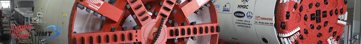
Phase 1 Information
Construction on Delhi Metro Phase 1 with 65.1 km of routes began in 1998. The first section opened in 2002 and the last section opened in 2006.
Estimated Cost: Rs. 10,571 crore
Funding Plan
- Japan International Cooperation Agency (JICA): 60%
- Government of India (GOI) Equity: 14%
- Government of Delhi (GNCTD) Equity : 14%
- Property Development: 7%
- Interest free subordinate debt towards land cost: 5%
Phase 1 Routes
This phase involved the construction of 3 new lines on broad gauge tracks:
Line-1 (Red Line): Shahdara – Rithala
- Length: 22 km
- Number of Stations: 18
- Station Names: Rithala, Rohini West, Rohini East, Pitampura, Kohat Enclave, Netaji Subhash Place, Keshav Puram, Kanhaiya Nagar, Inderlok, Shastri Nagar, Pratap Nagar, Pul Bangash, Tis Hazari, Kashmere Gate, Shastri Park, Seelampur, Welcome & Shahdara
Line-2 (Yellow Line) Vishwavidyalaya – Central Secretariat
- Length: 11 km
- Number of Stations: 10
- Station Names: Vishwavidyalaya, Vidhan Sabha, Civil Lines, Kashmere Gate, Chandni Chowk, Chawri Bazaar, New Delhi, Rajiv Chowk, Patel Chowk, Central Secretariat
Line-3 (Blue Line) Dwarka Sector-9 – Indraprastha
- Length: 32.1 km
- Number of Stations: 30
- Station Names: Dwarka Sector 9, Dwarka Sector 10, Dwarka Sector 11, Dwarka Sector 12, Dwarka Sector 13, Dwarka Sector 14, Dwarka, Dwarka More, Nawada, Uttam Nagar West, Uttam Nagar East, Janakpuri West, Janakpuri East, Tilak Nagar, Subhash Nagar, Tagore Garden, Rajouri Garden, Ramesh Nagar, Moti Nagar, Kirti Nagar, Shadipur, Kirti Nagar, Patel Nagar, Rajendra Place, Karol Bagh, Jhandewalan, RK Ashram Marg, Rajiv Chowk, Barakhamba Road, Mandi House, Pragati Maidan and Indraprastha
The embedded map below shows the exact location of all stations and can be zoomed into!
Phase 1 Route Map
An official PDF route map of Delhi Metro Phase 1 will be added here when available.
Key for map below: Phase 1 | Phase 2 | Phase 3 | Phase 4
History – Key Dates of Phase 1
• 25 Dec 2002: Shahdara – Tis-Hazari (Red Line) – 8.3 km
• 03 Oct 2003: Tis Hazari – Inder Lok (Red Line) – 4.1 km
• 31 Mar 2004: Inder Lok – Rithala (Red Line) – 8.9 km
• 19 Dec 2004: Vishwa Vidyalaya – Kashmere Gate (Yellow Line) – 4 km
• 03 July 2005: Kashmere Gate – Central Secretariat (Yellow Line) – 7 km
• 31 Dec 2005: Dwarka – Barakhamba (Blue Line) – 22.9 km
• 01 Apr 2006: Dwarka – Dwarka Sector 9 (Blue Line) – 6.5 km
• 11 Nov 2006: Barakhamba – Indraprastha (Blue Line) – 4.0 km
Menu: News & Construction Updates | Overview | Phase 1 Info | Phase 2 Info | Phase 3 Info | Phase 4 Info | Phase 5 Info | Metrolite Project
Page last updated: April 24, 2022. Have a question or spot an error? Let me know here.