Hyderabad Metro – Information, Route Maps, Fares & Updates
Menu: News & Construction Updates | Overview | Phase 1 Info | Phase 2 Info | Airport Metro Express Line | Fares & Smart Card Info
Information
Hyderabad Metro is an urban Mass Rapid Transit System (MRTS) being built to serve Hyderabad, the capital of Telangana.
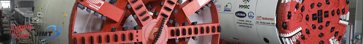
Construction for Hyderabad Metro’s 72 km Phase 1 on the Public-Private Partnership (PPP) model started in April 2012 by its concessionaire, L&T Metro Rail Hyderabad Limited (LTMRHL), and ended in February 2020 when the entire Green Line opening in one go.
Work on Hyderabad Metro’s 5 km MGBS – Falaknuma section of the Green Line could never begin due to local protests in the Old City, which led to Phase 1 getting truncated at 67 kms.
Hyderabad Metro’s Phase 2 project is currently in the proposal stage. Its Detailed Project Report (DPR) was submitted to the Telangana government for approval in February 2020. Routes have been modified multiple times since. The latest plan finalized in January 2024 includes 70 kms of routes.
System Specifications
• Top Speed: 80 kmph
• Average Speed: 35 kmph
• Track Gauge: Standard Gauge – 1435 mm
• Electrification: 25 kV, 50 Hz AC overhead catenary (OHE)
• Signalling: Communication-based Train Control (CBTC)
Key Figures
Operational: 67 km | Under Construction: 0 km | Approved but Unbuilt (Phase 1): 5 km | Proposed (Phase 2): 70 km
• Daily Ridership: 5.1 lakh/day (January 2024)
• Rolling Stock: 171 coaches (57 train-sets x 3) supplied by Hyundai Rotem
Hyderabad Metro Operational Lines (Phase 1)
• Line-1 (Red Line): Miyapur – L B Nagar (29.87 km, 27 stations)
• Line-2 (Green Line): JBS Parade Ground – MGBS (9.6 km, 9 stations)
• Line-3 (Blue Line): Nagole – Raidurg (28 km, 23 stations)
Hyderabad Metro Proposed Lines (Phase 2)
• Line-1 (Red Line): Miyapur – BHEL – Patancheruvu (14 km)
• Line-1 (Red Line): LB Nagar – Vanasthalipuram – Hayathnagar (8 km)
• Line-3 (Green Line): MGBS – Old City – Falaknuma – Chandrayangutta X Road (7 km)
• Line-3 (Blue Line): Nagole – LB Nagar – Chandrayangutta X Road – Mallardevpally Jct – Shamshabad Airport (29 km)
• Line-3 (Blue Line) – Raidurg – Biodiversity Junction – Nanakramguda Junction – Wipro Junction – American Consulate (Financial District) (8 km)
• Line-3 (Blue Line’s Spur) – Mallardevpally – Aramgarh – New High Court at Rajendra Nagar (4 km)
The embedded map below shows the exact location of all stations and can be zoomed into!
Hyderabad Metro Route Map (Operational)
An official PDF route map of Hyderabad Metro’s original Phase 1 network can be viewed and downloaded here.
Hyderabad Metro Future Network Route Map: Phase 1 & 2
Key: Line-1 (Red Line) | Line-2 (Green Line) | Line-3 (Blue Line)
Key: Phase 1 (Operational) | Phase 2 (Planned)
Hyderabad Metro Fare Chart (Ticket Prices)
| Zone | Distance from Origin | Fare |
| 1 | 0-2 km | Rs. 10 |
| 2 | 2-4 km | Rs. 15 |
| 3 | 4-6 km | Rs. 25 |
| 4 | 6-8 km | Rs. 30 |
| 5 | 8-10 km | Rs. 35 |
| 6 | 10-14 km | Rs. 40 |
| 7 | 14-18 km | Rs. 45 |
| 8 | 18-22 km | Rs. 50 |
| 9 | 22-26 km | Rs. 55 |
| 10 | >26 km | Rs. 60 |
Fares on the Hyderabad Metro are calculated based on distance traveled and dependent on type – RFID token (single journey) and smart card (best for multiple journeys) available for Rs. 20 with seasonal discounts (max 10%). Users can load amount in multiples of Rs. 50 up to a maximum of Rs. 3000. The card must always maintain a balance of Rs. 10.
Hyderabad Metro doesn’t offer a simple online fare calculator. The fare chart is available online here.
Hyderabad Metro Tenders
Latest Hyderabad Metro (HMRL) tender notices can be viewed on the HMRL’s website. News on these notices, their bidders and contracts are covered in further detail on the news & construction page.
Hyderabad Metro History (Key Dates)
Phase 1
• 29 November 2017: Nagole – Ameerpet (Blue Line) – 17.60 km
• 29 November 2017: Miyapur – Ameerpet (Red Line) – 12.20 km
• 24 September 2018: Ameerpet – LB Nagar (Red Line) – 16 km
• 20 March 2019: Ameerpet – HITEC City (Blue Line) – 8.5 km
• 29 November 2019: HITEC City – Raidurg (Blue Line) – 1.5 km
• 07 February 2020: JBS Parade Ground – MGBS (Green Line) – 11 km
Click on ‘News & Construction Updates’ below for project news, progress and updates.
Menu: News & Construction Updates | Overview | Phase 1 Info | Phase 2 Info | Airport Metro Express Line | Fares & Smart Card Info
Page last updated: September 14, 2025. Have a question or spot an error? Let me know here